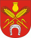
Kastsyukovichy (Kostyukovichi)
 |
Kastsyukovichy was first mentioned in a chronicle in 1508. It belonged to Poland, and in 1772, as a result of the First Partition of Poland, it was transferred to Russia. In the middle of the 19th century it had a population of 1700 and was the administrative center of Kostyukovichskaya Volost of Klimovichsky Uyezd, Mogilev Governorate. In 1919, Mogilev Governorate was abolished, and Kastsyukovichy was transferred to Gomel Governorate. On July 17, 1924 the governorate was abolished, and Kastsyukovichy became the administrative center of Kastsyukovichy Raion, which belonged to Kalinin Okrug of Byelorussian Soviet Socialist Republic. In July, 1927, Kalinin Okrug was abolished, and Kastsyukovichy was transferred into Mogilev Okrug. On January 15, 1938 the raion was transferred to Mogilev Region. In 1938, Kastsyukovichy was granted the town status. During the Second World War, the town was occupied by German troops and severely damaged.
The Jewish community of the village had 1,181 members before the war. The Germans occupied the town and kept the Jews imprisoned in a ghetto. They were forced to work in the quarry-sand. In November 1941, 350 Jews were murdered in a mass execution in the Orthodox cemetery perpetrated by an Einsatzgruppen. On September 3, 1942, the Jews were brought outside of the town when the Germans shot them in groups of 50 into pits. Before being shot, the Jews were forced to undress, and policemen and Germans collected their valuables. In March 1943, another 161 Jews were shot near the rope factory. On April 14 and 15, 1943, policemen from the town shot another 14 Jews.
In 1986, it was considerably affected by the Chernobyl disaster.
Map - Kastsyukovichy (Kostyukovichi)
Map


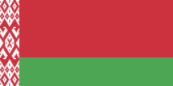
Country - Belarus
 |
 |
| Flag of Belarus | |
Until the 20th century, different states at various times controlled the lands of modern-day Belarus, including Kievan Rus', the Principality of Polotsk, the Grand Duchy of Lithuania, the Polish–Lithuanian Commonwealth, and the Russian Empire. In the aftermath of the Russian Revolution in 1917, different states arose competing for legitimacy amid the Civil War, ultimately ending in the rise of the Byelorussian SSR, which became a founding constituent republic of the Soviet Union in 1922. After the Polish-Soviet War, Belarus lost almost half of its territory to Poland. Much of the borders of Belarus took their modern shape in 1939, when some lands of the Second Polish Republic were reintegrated into it after the Soviet invasion of Poland, and were finalized after World War II. During World War II, military operations devastated Belarus, which lost about a quarter of its population and half of its economic resources. The republic was redeveloped in the post-war years. In 1945, the Byelorussian SSR became a founding member of the United Nations, along with the Soviet Union.
Currency / Language
| ISO | Currency | Symbol | Significant figures |
|---|---|---|---|
| BYN | Belarusian ruble | Br | 2 |
| ISO | Language |
|---|---|
| BE | Belarusian language |
| RU | Russian language |